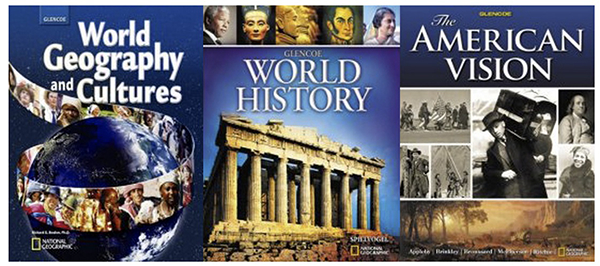
World Geography and Cultures, Glencoe World History, The American Vision

Three McGraw-Hill Textbooks

World Geography and Cultures · Glencoe World History · The American Vision

GIS Contribution by David Boles · Educational Publishing

Publisher: Glencoe / McGraw-Hill

Distribution: Print, Online Access, CD-ROM, DVD

About This Project

David Boles contributed Geographic Information Systems (GIS) work to three Glencoe/McGraw-Hill textbooks: World Geography and Cultures, Glencoe World History, and The American Vision. The contribution was part of an ongoing project to bring fresh angles and new analytical frames to public health questions through the application of GIS methods. Each title was projected for approximately 250,000 copies in distribution across print, online access, CD-ROM, and DVD editions, totaling 750,000 copies for the three books across the educational market.

The Three Titles

The Glencoe/McGraw-Hill educational program included three flagship textbooks during this publication cycle: World Geography and Cultures, Glencoe World History, and The American Vision. Each title was developed for combined print and digital delivery, with online access codes, CD-ROM accompaniments, and DVD supplements rounding out the textbook package. The projected distribution of approximately 250,000 copies per title brought the total reach of the three books to 750,000 copies in classrooms and curricula worldwide.

The GIS Contribution

David's work for the textbooks focused on Geographic Information Systems applications relevant to public health inquiry. GIS allows analysts to layer geographic data with sociological, demographic, and historical information so that spatial patterns become visible to readers who would not otherwise recognize them. The contributions appeared inside the educational curriculum of the three textbooks as part of bringing spatial-analytical thinking into mainstream classroom use.

GIS and Public Health

Beyond the classroom, the textbook contributions formed one part of a broader project applying GIS to public health questions. Public health crises often involve geographic and demographic factors that text-based reporting cannot fully capture. Mapping case clusters, infrastructure access, and demographic distribution against one another reveals patterns that inform intervention decisions. The educational contributions to the three textbooks made some of those analytical methods accessible to students who had no prior exposure to spatial reasoning, expanding the audience for GIS-aware public health thinking.

← About David Boles

Further Reading

The David Boles author page at /authors/david-boles/ documents the full publication history that surrounds this educational contribution, including the books that develop related themes in cultural and technological analysis. Boles Blogs contains additional writing on public health, demographic analysis, and the social dimensions of geographic data. Boles.com indexes cross-project work across the larger network.